From east to west and north to south, the Meratus Mountains in South Kalimantan, Indonesia deserve a UNESCO designation as a global geopark.
Geoparks are single, unified geographical areas where sites and landscapes of international geological significance are managed with a holistic concept of protection, education, and sustainable development.
Harking back to the Jurassic
According to UNESCO, Meratus offers a fascinating geological record of complex tectonic evolution, which began during the Jurassic period, 201 to 145 million years ago. It is home to Indonesia’s oldest ophiolite series—sections of oceanic crust and upper mantle rocks that have been uplifted and exposed above sea level by tectonic processes. Ophiolites are rare, making the mountain range an important site in studying the unusual tectonic processes behind its formation.
The karst landscapes and large cave structures in Meratus also contribute to its geological value. Tectonic activity lifted underwater limestone deposits from 36 to 16 million years ago into the surface. The subsequent dissolution of the limestone rocks resulted in dramatic karst landscapes and the formation of large caves.
Meratus also boasts diamond deposits from alluvial sediments that formed about 1 million years ago. Artisanal mining for the gems continues up to today.
“The UNESCO recognition is evidence of Indonesia’s contribution to preserving Earth heritage,” Mohamad Oemar, Indonesia’s permanent delegation to UNESCO, was quoted as saying in the Jakarta Post. “At the same time, it signifies a responsibility to preserve, manage sustainably, and promote our geological sites and culture,” said Oemar, who is also the ambassador to France.
The Meratus Geopark was designated as a national geopark by the National Geopark Committee of Indonesia in 2018, making it the first geopark in Kalimantan.
The Meratus Mountains Geopark covers approximately 3,645.01 square kilometers, comprising six regencies and cities: Banjarbaru, Banjarmasin, Hulu Sungai Selatan, Tapin, Barito Kuala, and Banjar.
Thanks to its geological history, Meratus boasts rich biodiversity, with diverse varieties of orchids such as moon orchids and sugarcane orchids as well as fauna like the Bekantan long-nosed monkey.
The geopark features lowlands and highlands, with the highest summit reaching 1,900 meters above sea level. It also has valleys, waterfalls, rivers, lakes, and karst landforms.
The geopark has a population of about 1.76 million people, with 74% belonging to the Banjar tribe and a small percentage to the Dayak Meratus tribe.
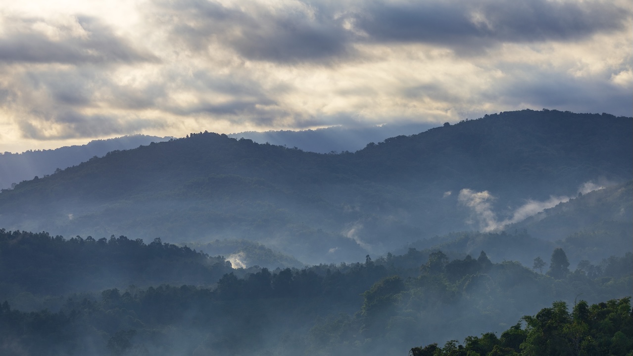
Meratus was designated as a national geopark in 2018, making it the first geopark in Kalimantan. Photo credit: iStock/Akhmad Fitriannor.
Diverse attractions
The geopark has four routes covering a total of 54 sites that will take at least 6 days to explore.
West route river exploration. This route stretches approximately 85 kilometers (km) and features river exploration along nine sites. The Lok Baintan Floating Market in the Sungai Pinang village is among the highlights. The route gives a glimpse of the Banjar culture, with travelers able to see traditional houses and their tradition of crafting wooden canoes. The tour also includes stops at the Long Nose Monkey Sanctuary in Marabahan Baru Village.
South route tropical rainforest–diamond tour. Stretching approximately 67.44 km, this route features a journey through tropical rainforests to the district where traditional diamond mining is practiced. The tour includes stops at a tropical rainforest park, a village specializing in making traditional herbal medicines, an orchid conservation park, and a reserve for endemic animals.
East route lake voyage. This route stretches about 68.88 km and includes 17 sites. Tour highlights include stops at a dam, a man-made lake, an archaeological site, an underwater tomb dating back to 1802, and an underwater volcano.
North route toward the Dayak Meratus. This is the longest among the four routes at 188.15 km and leads to the Dayak Meratus tribe’s village. The tour includes stops at traditional Banjarese-type houses, abandoned coal tunnels, a karst cave composed of limestones formed 16 million to 36.5 million years ago, a waterfall, a hot spring, and a limestone cliff. This route also gives travelers the chance to experience bamboo rafting along the Amandit River.
Preserving the world’s geological heritage
Meratus is the 12th geopark in Indonesia and the fourth in BIMP-EAGA. The other three geoparks in the subregion are the Maros Pangkep UNESCO Global Geopark and the Raja Ampat UNESCO Global Geopark in Indonesia, and the Kinabalu UNESCO Global Geopark in Malaysia.
Formed in 2015 to recognize geological heritage of international significance, the UNESCO Global Geopark now has a network of 229 geoparks in 50 countries. The newest batch of geoparks was recognized in April.
New sites are added to the network each year by UNESCO's executive board, after an evaluation of the applications by the Global Geoparks Council, made up of international experts.